 |
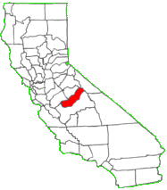
Gateway to Yosemite Exact Center of California |
|
|
Gateway to Yosemite Exact Center of California |
Madera County Gazetteer
|
|
||
|
|
|
|
|
|
|
1900
|
6,364
|
6,364
|
||
|
1910
|
8,368
|
2,404
|
5,964
|
|
|
1920
|
12,203
|
3,444
|
8,759
|
|
|
1930
|
17,164
|
4,665
|
847
|
11,652
|
|
1940
|
23,314
|
6,457
|
1,957
|
14,900
|
|
1950
|
36,964
|
10,497
|
3,893
|
22,574
|
|
1960
|
40,468
|
14,430
|
4,525
|
21,513
|
|
1970
|
41,519
|
16,044
|
4,349
|
21,126
|
|
1980
|
63,116
|
21,732
|
5,122
|
36,262
|
Webcams
| Webcams | Town by town, take a look as what is happening live. Weather, traffic, or just curious. |
Click on names for photo.
| Location | Description |
| Ahwahnee
(Gertrude) |
On Hwy 49, 5¼ from Oakhurst toward Mariposa. The word "Ahwahnee" is from the Indian name for the largest Indian Village in Yosemite Valley and for the Valley itself. Ahwahnee PO was opened in 1893, closed in 1896, reopened in 1900 when Gertrude PO was moved 2 miles north and the name changed to Ahwahnee, closed in 1907, and reopened in 1917. Gertrude PO was opened in 1881, closed in 1893, reopened in 1896, moved 2 miles south in 1899, and closed in 1900. The name "Gertrude" was for the wife of John Haley, owner of the Enterprise Mine; the place was first called String Town and was located south of Ahwahnee near the Fresno River. |
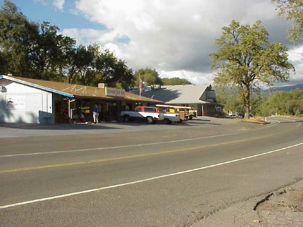
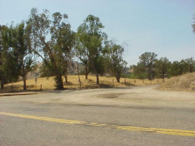
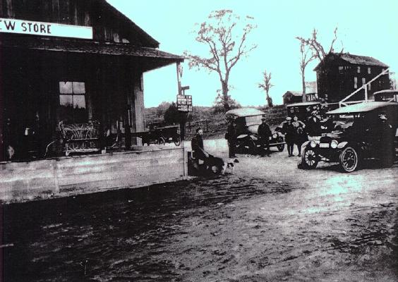
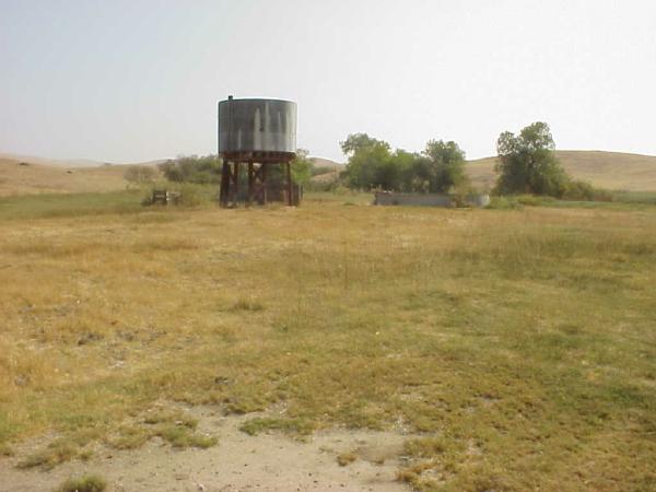
| Bailey Flats (Mist) | 10 miles north-northeast of Raymond at the junction of Roads 800, 810, and 812. Mist PO was opened in 1913 and closed in 1935 in favor of Raymond. The PO was in a general store in Bailey Flat near the Chowchilla River. It was named for the mist of a nearby waterfall. The sign on the Bailey Flat Cash Store at the left of the porch reads: POST OFFICE MIST CAL. |
| Bass
Lake
(Crane Valley) |
Off Hwy 41, 4½ miles from Yosemite Forks on Northeast shore of lake. POs at Pines Village opened in 1912. A dam flooded Crane Valley in 1895 and was enlarged in 1910. It was named Bass Lake after the reservoir was stocked with bass. |
| Bates
Station
(Prewett Station) |
10½ miles south-southeast of Raymond, near junction of Roads 209 and 406. Bates PO was opened in 1883, moved 5 miles south in 1891, and closed in 1903 in favor of Sesame. The name was for George Bates, who operated Bates Station and was first postmaster; Henry J. Prewett became postmaster in 1889 and the places was sometimes called Prewett Station, but the PO retained the old name. |
| Bellview
(Sesame) |
5½ miles south-southwest of O’Neals at the junction of Road 211 with 208 and 210. Bellview PO was opened in 1894 and closed in 1896 in favor of O’Neals. Sesame PO was opened in 1902 and closed in 1913 in favor of Friant (Fresno Co.). Nothing remains. Bellview Store. |
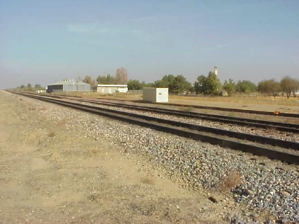
| Berenda (Berendo) | 3½ miles southeast of Fairmead along Southern Pacific Railroad, near Berenda Creek and Highway 99. The name is a corruption of the "berrenda" which means "antelope" in Spanish. Berendo PO was opened in 1873, the name was changed to Berenda in 1919, and closed in 1935 in favor of Madera. |
| Bethel | Bethel PO (Old Town) was opened 4 miles west of North Fork in 1881 and closed in 1885; it was named for James W. Bethel, who owned the store that housed it. |
| Borden (Arcola) | 3 miles southeast of Madera along the Southern Pacific Railroad, north of Avenue 12 and divided by Highway 99. The area was populated in 1868 by families from Alabama and was called Arcola after a plantation in Alabama owned by one of the settlers. When the railroad came in 1872 the name became Borden, for Dr. James Borden, a leader of the community. Borden PO was opened in 1873, closed for 3 months in 1896, and closed in 1906 in favor of Madera. |
| Brown’s | See North Fork. |
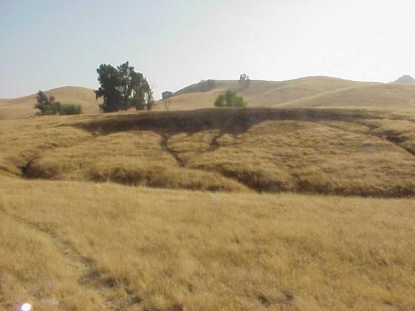
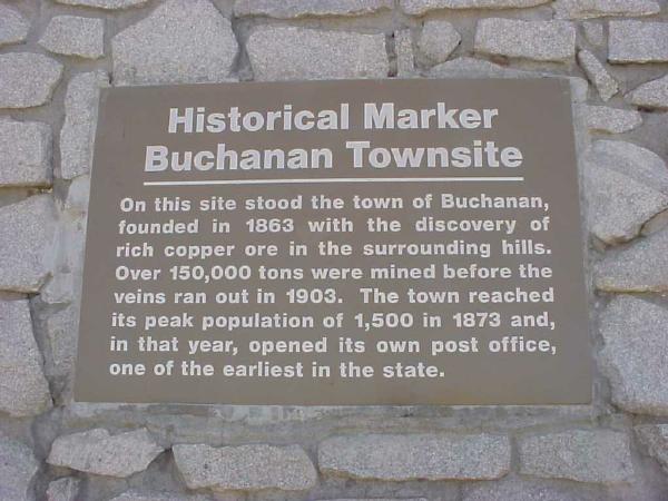
| Buchanan | 5 miles west of Raymond near the site of Buchanan Dam which forms Eastman Lake. Buchanan PO was opened in 1873 and closed in 1904 in favor of Raymond. Buchanan took its name from Buchanan Hollow, which extends along the Chowchilla River for about 2 miles just northeast of the place where Madera, Mariposa, and Merced counties meet. Buchanan Hollow was named for a settler in the 1860s. Historical Marker. |
| Califa | 1 mile northwest of Fairmead along the Southern Pacific Railroad. Califa PO was opened in 1912 and closed in 1915 in favor of Fairmead. |
| Cascadel | Cascadel PO was opened 4 miles east of North Fork PO in 1892 and closed in 1896; it was named for Cascadel Ranch on Whisky Creek, which in turn was named for Cascadel Point. |
| Chowchilla | 15 miles northwest of Madera just off Hwy 99. Chowchilla PO was opened in 1912. The town was incorporated in 1923. The name "Chowchilla" is a corruption of the designation of a warlike Indian tribe that lived along the Chowchilla River; the Indian name is said to have the meaning "murderers." |
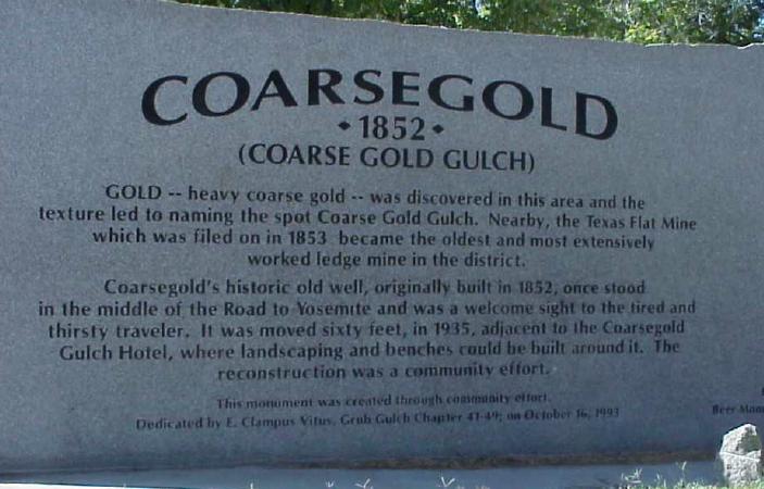
| Coarsegold
(Coarse Gold) (Coarse Gold Gulch) (Texas Flats) |
8 miles south of Oakhurst on Hwy 41 along Coarse Gold Creek. Coarse Gold Gulch PO was opened in 1878, and the name changed to Coarsegold in 1899. Miners from Texas found gold at the place in 1849 and the community that developed there first was knows as Texas Flats. In 1874 the area was called Michaels for Charles Michaels that operated the first business there. Mexican miners called the area Oro Grosso. Historical Marker. |
| Daulton | 8 miles south-southwest of Raymond along Daulton Creek and the Southern Pacific Railroad. Railroad officials named the place in the 1860s for Henry C. Daulton, who gave the right of way through his property; Mr. Daulton was chairman of the commission that organized Madera County. Daulton PO was opened in 1899 and closed in 1908. |
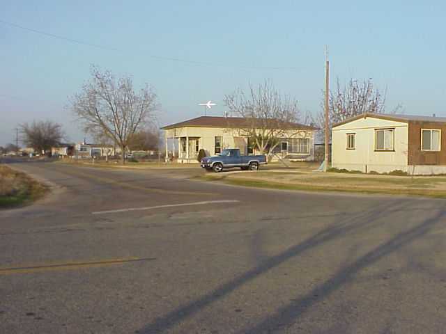
| Fairmead | 11 miles northwest of Madera off Highway 99. Fairmead PO was opened in 1913 and closed in 1940. |
| Femmon | Femmon PO was opened 3 miles north of Nipinnawasee in 1912 and was moved later that year to Nipinnawasee and reopened by that name. The name "Femmon" honored Frank Femmon, pioneer farmer who developed a prize-winning apple. |
| Fine
Gold
(Gold) |
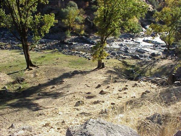
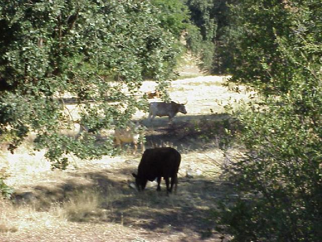
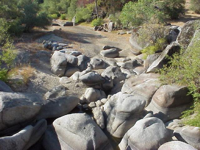
6½ miles west-southwest of North Fork along Fine Gold Creek on Road 211. Fine Gold PO was opened in 1881 and closed in 1882. The inhabitants moved a little way east, where a new PO was called Gold was opened in 1894 and closed in 1907 in favor of O’Neals. The name was take from the Spanish "oro fino." Little remains except cattle. PHOTO - Fine Gold Creek from Road 210 bridge. |
| Flume | Location? A PO was opened in 1888 and closed in 1893. Probably named for the flumes which transported logs to the mills. |
| Gertrude | See Ahwahnee. |
| Gold | See Fine Gold. |
| Greenleaf | See Gregg. |
| Gregg
(Greenleaf) |
2½ miles south-southeast of Trigo along Atchison Topeka and Santa Fe Railroad. Greenleaf PO was opened in 1904 and closed in 1905 in favor of Madera. Gregg PO was opened in 1917, closed for a month in 1928, and closed in 1931 in favor of Madera. |
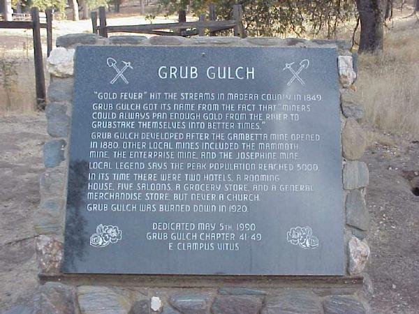
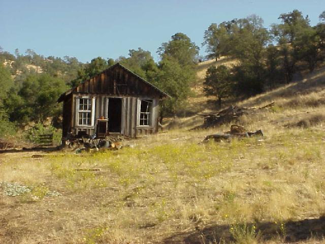
| Grub Gulch | 10½ miles northeast of Raymond. Grub Gulch PO was opened in 1883 and closed in 1918 in favor of Raymond. |
| Hildreth | 3½ miles east-southeast of O’Neals on Road 210. Hildreth PO was opened in 1886 and closed in 1896. Little remains. |
| Italian Swiss Colony | A winery outside Madera. A PO was opened in 1964. |
| Jones Precinct | High mountian area of Eastern Madera County. Named for Jones Store at Beasore Meadows. |
| Knowles
(Hillside) |
1½ miles from Raymond. Knowles PO was opened 1902 and closed in 1955. The name commemorates F. E. Knowles, who operated the granite quarry there. A 1934 map shows a place called Hillside just southwest of Knowles along the Southern Pacific railroad. |
| La Vina | 6½ miles south-southwest of Madera. La Vina PO was opened in 1891 and closed in 1895 in favor of Madera. The place started as part of an unsuccessful land development scheme. |
| Leach’s Store | Near Oakhurst. A PO was opened in 1855 and closed in 1859 in favor of Coarse Gold Gulch. |
| Madera | The county seat at the junction of Hwy 99 and Hwy 145 on the Fresno River. Officials of the California Lumber Company had the town laid out in 1876 at the end of a flume that brought lumber 63 miles from the mountains to the railroad. Madera means "wood" or "timber" in Spanish. Madera PO has been open since 1877. The town was incorporated in 1907. |
| Magnet | Magnet PO was opened 4 miles northeast of O’Neals at the Magnet Mine in 1904 and closed in 1907 in favor of O’Neals. |
| Media | Media PO was opened 5 miles southwest of Bates near the junction of Roads 400 and 406 in 1894 and closed in 1898. The name "Media" was from the belief that the place was the geographical center of California. When Madera County was separated from Fresno County in 1893 residents of the mountainous part of the counted wanted the county seat near them; they started a town about 15 miles east of Madera, named it Minarets (Media), and intended that it be the county seat, but the scheme failed. |
| Miami | Miami PO was opened 8 miles southwest of Grub Gulch in 1884 and closed in 1887 in favor of Raymond. The name was transferred from the Miami River region of Ohio. |
| Minarets
(Also see Media) |
A PO called Minarets was opened in 1925 about 5 miles southeast of the North Fork PO and closed in 1933; the place was the terminal of the Minarets and Western Railroad. |
| Minturn | 1½ miles north-northwest of Chowchilla along the Southern Pacific Railroad. Minturn PO was opened in 1884 and closed in 1922 in favor of Chowchilla. The name commemorates Jonas and Thomas Minturn, who grew wheat in the region and arranged for a freight siding when the railroad reached the place in 1872. |
| Mist - See Bailey Flats | 10 miles north-northeast of Raymond at the junction of Roads 800, 810, and 812. Mist PO was opened in 1913 and closed in 1935 in favor of Raymond. The PO was in a general store in Bailey Flat near the Chowchilla River. It was named for the mist of a nearby waterfall. The sign on the Bailey Flat Cash Store at the left of the porch reads: POST OFFICE MIST CAL. |
| Narbo | See Quartz Mountain. |
| Nipinnawasee | 6¼ miles west-northwest of Oakhurst. Femmon PO was opened 3 miles north of Nipinnawasee in 1912 and was moved later that year to Nipinnawasee and reopened by that name. Nipinnawasee PO was closed in 1961. The name is of Indian origin from Michigan. |
| North
Fork
(Brown’s) (Old Town) |
South of Bass Lake. North Fork PO opened in 1888. Milton Brown was the first settler at the site and the community that grew there was called Brown’s; it became known as North Fork after the North Fork Lumber Company office was opened 4 miles east of North Fork PO in 1892. |
| O’Neals | On Road 211 between Madera and North Fork along Willow Creek. O’Neals PO was opened in 1887. Charles O’Neal bought the store at the place in 1878 and operated a small hotel; he was postmaster. A store, post office, and elementry school now serve the people scattered in the hills. |
| Oak | Oak PO was opened 13 miles southeast of Borden in 1894 and closed later the same year. |
| Oakhurst
(Fresno Flats) |
At the junction of Hwy 41 and Hwy 49 along the Fresno River at the east end of Fresno Flats. Fresno Flats PO was opened in 1873; the PO was moved and the name changed to Oakhurst in 1912. |
| Old Town | See North Fork. |
| Oro Grosso | See Coarsegold. |
| Quartz Mountain
(Narbo) |
4½ miles north of O’Neals at 2752 feet. The French-financed Quartz Mountain Mill Company had land near the peak. Narbo PO was opened there in 1884, moved in 1887, and was closed later the same year. The name "Narbo" was from Naarbonne, the name of one of the French promoter of the mill. |
| Rallsville | Rallsville PO was opened 20 miles northeast of Madera in 1881 and closed in 1883 when services were moved to Coarse Gold Gulch; the PO was named for George W. Ralls, the first postmaster. |
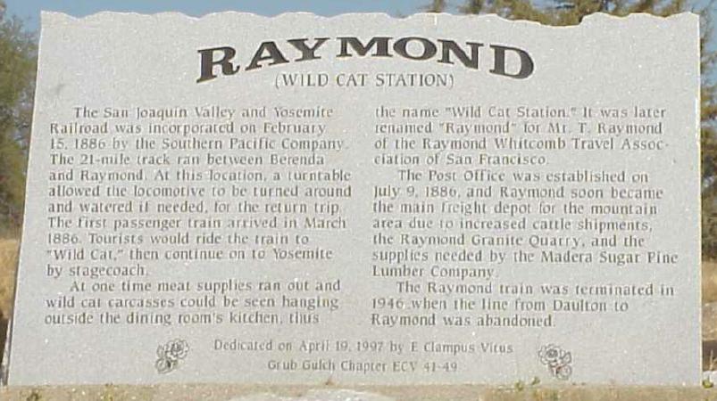
| Raymond
(Wild Cat Station) (Herbert) |
20 miles north-northeast of Madera on Road 600. Raymond PO was opened in 1886. The place was first called Wild Cat Station; when the Southern Pacific Railroad reached the site in 1886 the station there was called Raymond for Mr. T. Raymond of the Raymond-Whitcomb Travel Association. Historical Marker. A 1934 map shows a place called Herbert located along the railroad 1 1/4 miles south of Raymond. |
| Reds Meadow | ½ mile southeast of Devils Postpile National Monument. The name commemorates Red Sotcher (or Satcher) who came to the place in 1879 to herd sheep. A PO was opened in 1968 and closed in 1974 in favor of Mammoth Lakes |
| Sesame | See Bellview. |
| Sharon | 4 miles east-northeast of Fairmead along the Atchison Topeka and Santa Fe Railroad. Sharon PO was opened in 1898, discontinued for 5 months in 1927, and closed in 1934 in favor of Chowchilla. The place began as part of a real estate promotion on land owned by San Francisco financier William Sharon. |
| Starville | Located 23 miles northeast of Fresno Flats (Oakhurst), Starville PO was opened in 1889 and closed in 1891; the name was from the Star Mine. |
| Sugar Pine | 5 miles north of Yosemite Forks. Sugar Pine PO was opened in 1907 and closed in 1934 in favor of Oakhurst. Madera Sugar Pine Company build a sawmill and company town at the place in 1899 and 1900. |
| Trigo
(Patterson) (Lankershim) |
7 miles east-southeast of Madera at the junction of Road 23 and Avenue 11. A 1908 map calls it Patterson. Trigo PO was opened in 1912 and closed in 1942 in favor of Madera. A 1950 map shows a place called Lankershim located about 3½ miles northwest of Trigo along the Atchison Topeka and Santa Fe Railroad. |
| Wishon | On the south shore of Bass Lake near the dam and the Minaret and Western Railroad. The Wishon PO was opened in 1923. The name commemorates A. Emory Wishon of San Joaquin Light and Power Corporation, later vice president of Pacific Gas and Electric Company. |
| Zebra | 10 miles southeast of Raymond. Zebra PO was opened 6 miles northeast of Bates in 1886, closed in 1888, opened in 1890, closed for a few months in 1894, moved 4½ miles southwest in 1901, and closed in 1904 in favor of O’Neals. The name was from the Zebra Mine which had dark and light ore veins. |
Some notes from David L. Durham, "Geographic Names of Madera County California," (Fresno: Pioneer Publishing Co., 1987).
Madera County Schools - Photos of schools in many of the above towns.
Last
update: July 11, 2025
Return to Madera County
Home Page,
E-mail Comments.