Doing Research
In Sonoma County
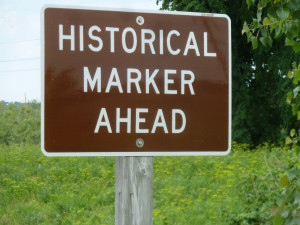
Landmarks & Historical Markers
Found In Sonoma County
Little did I know when I started making this
list of lists, that there were so many different types
of historical memorials out there. There are historical
landmarks, both nationally
recognized and state
recognized, historical buildings, and historical markers
that mark historical events. I was getting lost looking at the
lists, so many times they overlapped the historical
place, yet would mark a different plaque. And if you know
me, you know I love making
lists, so I went ahead and made a list to combine all of
the above mentioned lists. I sorted them by town to make them
easier to find.
Lists
of Landmarks & Historical Markers
California
Historical Landmarks: Sonoma County . . . Link
California Historical Landmarks: Sonoma County (Wikipedia) . . . Link
California State Historical Landmarks: Sonoma County (Lairds Place) . . . Link
Historic
American Buildings Survey: Sonoma County . . .
Link
Historical Landmarks (Sonoma County Ca Genealogy Trails) . . . Link
Historic Sites and Points of Interest in Sonoma County (NoeHill) . . . Link
Historic Sites of Sonoma County (CA Parks Office of Historic Preservation) . . . Link
Landmark Hunter: Sonoma County . . . Link
National Register of Historic Places Listings in Sonoma County, California (Wikipedia) . . . Link
The Historical Marked Database: Sonoma County . . . Link
Searching for More
Waymaking . Com a site where you can add your own notes about visiting historical places . . . Link
Wikipedia Commons may have more pictures of the listed places . . . Link
Other
Historical Things
Bridge Hunter . . . Link
California
Missions Museum . . .
Link
Fort Ross State
Historic Park. . . Link
Historic Bridges.
Org: Sonoma County .
. . Link
Jack London State
Historic Park . . . Link
Lists of historical landmarks, with California Facts for Kids (Kiddle Page) . . . Link
Luther Burbank
Home & Gardens . . . Link
Petaluma Adobe
State Historic Park . . . Link
Society For
California Archaeology .
. . Link
Sonoma County Courthouse Through Postcards . . . Link
Sonoma State
Historic Park .
. . Link
Landmarks & Historical Places by City/Town
"NL No." = Entry from National Historical LANDMARK Registry (IN ALL CAPS)
"NRHP." = Entry from National Register of Historic Places Listings . . . Link
"M No." = Entry from The Historical MARKER Database
"SCHL" = Sonoma County Historic Landmarks and Districts (designated by Sonoma County Landmark Commission) . . . Link
Asti
NL NO. 621 ITALIAN SWISS COLONY - Here in 1881 Italian immigrants established an agricultural colony. Choice wines produced from grape plantings from the Old World soon brought wide acclaim. By 1905, 10 gold medals had been awarded these wines at international competition. Location: 10 mi S. on Asti Post Office Rd from Asti Rs, thru Winery Gates, plaque at office door, Asti . . . WikiPage Asti . . . Plaque/Site Images . . .
Bodega
M No. 87564 Potter School Est. 1873 - Sheriff Samuel Potter donated the land for this public school in 1872. In September of 1873 classes for grades 1 through 8 were held in two large classrooms on the first floor. The upstairs functioned as a multi-use room and community hall. In December of 1961 the condemned school building was sold by auction to the highest bidder. In March of 1962 Alfred Hitchcock used the school in his film, "The Birds" . . . Marker Database . . . History . . .
M No. 80698 Running Fence (see also Valley Ford) - On September 11, 2001 the Board of Supervisors of the County of Sonoma selected this site to commemorate the contribution of Christo and Jeanne-Claude. Rising from the Pacific Ocean south of Bodega Bay the 18 foot high 24.5 mile long Running Fence ran west to east following the rolling hills of Marin and Sonoma counties to Cotati ridge . . . WikiPage . . . Marker Database . . .
NL NO. 820 ST. TERESA'S CHURCH - Constructed of redwood in 1859 by New England ship's carpenters on land donated by Jasper O'Farrell, the church has served this coastal community continuously for over a century. Father Louis Rossi was appointed pastor on March 8, 1860, and Archbishop Alemany dedicated the church on June 2, 1861. Location: Bodega Hwy near Bodega Ln, Bodega . . . WikiPage . . . Plaque/Site Images . . . Marker Database . . .
NRHP Watson School (1857-1967)- a Sonoma County Regional Parks Department historic park, covering approximately 0.75 acres (0.30 ha), located about 2 miles (3.2 km) east of Bodega, California, on the south side of the road, at 15000 Bodega Highway in Sonoma County, California, United States. It was listed on the National Register of Historic Places in 1978 . . . WikiPage . . . Marker Database . . .
Bodega
Bay
M No. 73709 Bodega Bay - Named for Lt. Juan Francisco de la Bodega y Quadra, who discovered the Bay of Bodega on October 3, 1775. Russian settlement originally called Kuskoff, founded by M de Kuskoff. In 1843 Stephen Smith an American, erected in this vicinity the first steam grist and sawmill in California . . . Marker Database . . .
NL NO. 833 BODEGA BAY AND HARBOR - Discovered in 1602-03 by Vizcaino's expedition, the bay was named by Bodega in his survey of 1775. The harbor was used in 1790 by Colnett and in 1809 and 1811 by the Kusov expeditions. The Russian-American company and their Aleut hunters used the bay as an outpost until 1841, Stephen Smith took control in 1843. Pioneer ships of many nations used Bodega Bay as an anchorage. Location: Doran Park, 1.6 mi W of State Hwy 1 (P.M. 9.4), on Doran Beach Rd, 0.5 mi S of Bodega Bay . . . WikiPage (Harbor) . . . WikiPage (Bay) . . . Plaque/Site Images . . .
M No. 87570 The Children's Bell Tower: Nicholas Green Memorial - The Children's Bell Tower is dedicated to children everywhere. It was inspired by the death of seven-year old Nicholas Green of Bodega Bay who was shot by highway robbers while on vacation with his parents in Italy, on September 29, 1994 . . . WikiPage . . . Marker Database . . . More about . . .
Calistoga
NL NO. 915 PETRIFIED
FOREST - The petrified forest, historically and
scientifically significant as the state's only petrified
forest dating from the Eocene period, is unique in its size,
scope, and variety of petrification. Discovered in 1870, the
forest is about a mile long by half a mile
wide. Location: 4100 Petrified Forest Rd, 5 mi NW of
Calistoga . . . WikiPage
. . . Plaque/Site
Images .
. . Marker
Database . . . And MD (2) . . . Site Home Page
. . . History . .
.
M No. 102524 To Commemorate..."Petrified Charlie" - To Commemorate the discovery of the petrified forest by "Petrified Charlie" in the year 1870 . . . Marker Database . . . Charles Evans ("Petrified Charley") . . .
Cloverdale
NL NO. 981 ICARIA-SPERANZA COMMUNE - Icaria-Speranza was a Utopian community based on the writings of French philosopher Etienne Cabet. In 1881, at Cloverdale, French immigrant families led by the Dehay and Leroux families began their social experiment in cooperative living based on solidarity and depending on an agrarian economy. It lasted until 1886. Icaria-Speranza was the only Icarian Colony in California and the last of seven established throughout the United States. On this site stood the Icarian schoolhouse, deeded to the county in 1886. Location: W side of Asti Rd, 1.68 mi N of Asti Post Office Rd, S of Cloverdale . . . WikiPage . . . Plaque/Site Images . . . Marker Database . . . Article on History . . .
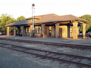
NRHP #76000536 Cloverdale Railroad Station - A rail station previously served Cloverdale along the original Northwestern Pacific Railroad and was listed on the National Register of Historic Places in 1976 as Cloverdale Railroad Station. Train service began in 1872; the station was 82.5 by 32.3 feet (25.1 m × 9.8 m) in plan, of a "never numerous" but important rural railroad station type. That station, however, was destroyed in a fire in 1991 . . . WikiPage . . .
M No. 102479 Cloverdale Reveille Newspaper - The "Cloverdale Reveille" is the oldest weekly newspaper continuously published under the same name in the state of California. Founded in the 1870s, and surviving the ups and downs of frontier journalism, the "Cloverdale Reveille" was adjudicated by the Sonoma County Superior Court. The "Cloverdale Reveille" is still publishing under the same name and court order issued long ago . . . Marker Database . . .
M No. 109979 Gould-Shaw House - Gould-Shaw House Thomas Jefferson Gould, an Indiana born blacksmith, built this house, which has become an important part of the town’s history, in 1862. One of the few surviving examples of Gothic Revival architecture, the house is the oldest documented dwelling in Cloverdale . . . WikiCommons Pics . . . Marker Database . . .
M No. 102480 Isaac E. Shaw Building - This simple, false-front building built in 1875 as a post office and express office, is the second oldest commercial building in Cloverdale and one of only four surviving Cloverdale commercial buildings considered historic. Isaac Shaw, the first owner of the building, was a major figure in the early development of Cloverdale. This property is listed in the National Register of Historic Palces by the United States Department of the Interior c. 1880. NRHP reg #90002155 . . . WikiFile . . . Marker Database . . . SC Library Pictures . . .
Cotati
NL NO. 879 COTATI DOWNTOWN PLAZA - Cotati's hexagonal town plan, one of only two such in the United States, was designed during the 1890s by Newton Smyth as an alternative to the traditional grid. Each of the streets surrounding the six-sided town plaza, where early settler Dr. Thomas Page's barn once stood, is named after one of Page's sons, 'Cotati' derives from the name of a local Indian chief. Location: Downtown plaza, SE corner of Old Redwood Hwy and E Cotati Ave, Cotati . . . WikiPage . . . Plaque/Site Images . . . Marker Database . . . Dr. Thomas Stokes Page . . .
M No. 152689 Veronda/Falletti Ranch - This 4.37 acre property is known as Veronda-Falletti Ranch. Its 2008 purchase and long-term protection as public open space, is a partnership between the City of Cotati and the Sonoma County Agricultural Preservation and Open Space District. The Veronda family purchased the property in 1938 and began raising chickens, at one time supporting a flock of nearly 3,000 . . . Marker Database . . .
Duncan Mills
M No. 102508 Duncans Mills Depot Museum: Historical Local Wooden Railroad Cars - The NPC operated in the northern California counties of Marin and Sonoma that carried redwood lumber, local dairy and agricultural products, express and passengers. The NPC operated almost 93 mi (150 km) of track that extended from a pier at Sausalito (which connected the line via ferry to San Francisco) and operated northwest to Duncans Mills and Cazadero (also known as Ingrams) . . . Marker Database . . . Duncans Mills (WikiPage) . . . North Pacific Coast Railroad (WikiPage) . . .
M No. 80693 First Time Black Bart Left Poetry At Stage Holdup - On 3 August 1877 the Wells Fargo stage from Fort Ross to Duncans Mills was robbed by Black Bart (aka Charles E. Boles, Bolton, T.Z. Spaulding) using his feared command, “Throw down the box!” It was Black Bart’s fourth stage holdup and the first time he left poetry at the scene . . . Marker Database . . . Black Bart (WikiPage) . . . Black Bart Page . . .
Eldridge
M. No. 102558 Sonoma Dev. Center: The Main Building - "The Main Building" was constructed in 1908 to replace the administration wing that had been severely damaged in the 1906 earthquake. The building served as the main administration building from 1908 to 1957. It was used as the professional education center from 1957 to 1980. . . WikiPage . . . Marker Database . . .
Forestville
NL NO. 835 COOPER'S SAWMILL - In 1834, Mariano G. Vallejo's brother-in-law, John B. R. Cooper, constructed California's first known power-operated commercial sawmill. In addition to sawing redwood lumber, the mill and surrounding settlement served as a barrier to Russian encroachment from the west. Located on Mark West Creek, the waterpowered mill was destroyed by flood in the winter of 1840-41. Location: SW corner, intersection of Mirabel and River Rds (P.M. 174) near Mirabel Park, 8 mi W of Santa Rosa . . . WikiPage . . . Plaque/Site Images . . . Marker Database . . . Photos: Old Sawmills of Sonoma County (Press.Demo.) . . . Article Name History (Press.Demo.). . .
Freestone
M No. 2 Freestone House (Hinds Hotel) - The Hinds Hotel (also known as the Freestone House, Freestone Hotel, Park House, and Wayside Inn) built in 1876, the Hinds Hotel is a former hotel, antique store and plant nursery . . . WikiPage . . . Link . . .
Glen Ellen
M
No. 26468 Charles J. Poppe Building
- Site of the Poppe Dry Goods & General
Merchandise Store (1883-1937), and
Glen Ellen Post Office. First
built of wood in 1883, Destroyed
by fire in 1905, Rebuilt
of stone with two stories in 1906, then Damaged
in 1906 Earthquake and again Rebuilt
with three stories in 1907 top two stories of wood.
. . Marker
Database . . . New Article . .
M No. 24961 Glen Ellen Cannon - In early 1905 through the efforts of General Wagner, this Civil War Era cannon was delivered to Glen Ellen where it was placed in the center of town. It has continuously been recognized as the town marker and as a symbol of community for the town. . . Marker Database . . .
NL NO. 743 JACK LONDON STATE HISTORIC PARK - This is the 'House of Happy Walls,' built in 1919 by Charmian K. London in memory of her husband, renowned author Jack London. Here are housed many of his works and the collection gathered in their travels throughout the world. In 1960 Charmian's house, the ruins of Jack's 'Wolf House,' and his grave were presented to the State by his nephew, Irving Shepard. Location: Glen Ellen . . . WikiPage . . . Plaque/Site Images . . . Marker Database . . . Site Home Page . . . Jack London (Wikipedia) . . . Jack London Bio . . .
M No. 102535 Jack London Had A Dream - This marker is located on Lake Trail at Beauty Ranch in Jack London State Historic Park. . . Marker Database . . .
M No. 102536 Jack London experimented by growing spineless cactus for livestock feed - This marker is located at Beauty Ranch in Jack London State Historic Park. . . Marker Database . . .
M No. 102537 Eucalyptus: The Cash Crop that Failed - This marker is located on Lake Trail at Beauty Ranch in Jack London State Historic Park. The Park is at the end of London Ranch Road. . . Marker Database . . . Article . . .
M No. 102538 Jack London's Terraces Shaped the Land for Preservation - This marker is located at Beauty Ranch in Jack London State Historic Park. . . Marker Database . . .
M No. 102539 The Old Winery - This marker is located near the "Cottage" at Beauty Ranch in Jack London State Historic Park. . . Marker Database . . .
M No. 102553 "We live in a beautiful part of the country." - Outside the cottage of Jack and Charmian London . . . Marker Database . . . The Cottage . . .
M No. 102554 Jack and Charmian London Entertained Here - This marker is located near the Cottage at Beauty Ranch in Jack London State Historic Park. . . . Marker Database . . .
M. No. 102556 Horse Power and Manure Were Put to Work on London's Beauty Ranch - This marker is located near the horse barns at Beauty Ranch in Jack London State Historic Park . . . Marker Database . . . The Beauty Ranch . . .
M No. 102537 Eucalyptus: The Cash Crop that Failed - This marker is located on Lake Trail at Beauty Ranch in Jack London State Historic Park. The Park is at the end of London Ranch Road. . . Marker Database . . . Article . . .
M No. 176140 Jack London Ranch - From the parking lot, head up the path to the house. The marker is along the path a short distance from the lot. . . Marker Database . . .
Guerneville
M No. 99576 Bank of Guerneville - This beautiful Beaux Arts Building was designed by Carl Ingomar Warnecke of the architectural firm Miller and Warnecke in 1921. The Bay Area firm designed residential work, apartment buildings, schools, commercial and civic structures. . . Marker Database . . .
M No. 107151 Guerneville Historical Marker - Although the marker is on the main road running through town, River Road (Highway 116), the marker is easy to miss, as it sits below a Safeway sign. The text is visible only when heading west. . . Marker Database . .
M
No. 102507 Korbel Station Erected
in 1876 - This was the terminus of the
"Fulton-Guerneville" branch of the Northwestern Pacific
Railway which began operations on May, 29, 1872.
. . Marker
Database . . .
M No. 107311 Pioneers of Preservation - Colonel James B. Armstrong came to California from Ohio in 1874 as a land investor. He devoted the later years of his life to saving Armstrong Woods for future generations. After passing away in 1900, his family and friends continued those early and important preservation efforts. . . Marker Database . . . James B. Armstrong . . . Lizzie Armstrong Jones . . . Armstrong Redwoods . . . Also about Park . . .
Healdsburg
M No. 42518 Harmon Gregg Heald (1824 - 1858) Founder of Healdsburg in 1851 - First building was Heald's cabin located 150 feet west of this spot. 1852 he built his store and post office 100 feet north of here. City created 1857. . . Marker Database . . .
M
No. 102492 March/Heald Flour Mill
- Millstone from pioneer flour and saw mill built by
William March and Samuel Heald on Mill Creek in 1849 . . . Marker Database . .
. William March . . . Samuel Heald . . .
NL NO. 893 WALTERS RANCH HOP KILN - This is the most significant surviving example of a stone hop kiln in the North Coast region. Built by Angelo 'Skinny' Sodini in 1905, it served the Russian River Valley and North Coast regions, once the major hop-growing areas in the West. In the latter part of the 19th century, Sol Walters purchased 380 acres, part of the Sotoyome Rancho patented in 1853, from Josefa Fitch. Location: 6050 Westside Rd, Healdsburg . . . No WikiPage . . . Plaque/Site Images . . . Marker Database . . .
M No. 159544 Wohler Ranch 1856 - In 1856, 1500 acres of the 17,892 acre Rancho El Molino were a "gift of love" to Mariano Vallejo's niece Anna Wohler. In the 1880's hops pioneer Raford Peterson purchased the land . . . Marker Database . . . Rancho El Molino . . . Anna Maria Cooper & German Hermann Wohler . . .
Jenner
NL NO. 5 FORT ROSS - Founded in 1812 by
Russians from Alaska. When Russians withdrew to Alaska in
1841, Captain Sutter bought the improvements and supplies.
The State acquired the fort in 1906 and the remaining
buildings-Greek Orthodox Chapel, Commandant's Quarters, and
Stockade-were restored. The chapel, destroyed by fire in
1970, was reconstructed in 1974. Location: 19005 Coast Hwy,
State Hwy 1 (P.M. 33.0), 12 mi N of Jenner . . . WikiPage .
. . Plaque/Site Images .
. . Marker
Database . . . Location HomePage
. . . More Pictures .
. . History
. . . Book of History
. . . Establishment . . .
M No. 16357 The Call Family Residence (1878 - 1972) - George Washington Call (1829-1907) and his Chilean wife, Mercedes Leiva (1850-1933), bought 2,500 acres including Fort Ross in 1873. . . Marker Database . .
M No. 16361 The Native Alaskan Village - Native Alaskans, brought to Fort Ross by the Russian-American Company to hunt sea mammals and provide a work force for the colon, established a village on the marine terrace in front of the fort. . . Marker Database . . .
M No. 16362 Sandy Beach Cove - Sandy Beach Cover lies below the fort. . . Marker Database . . .
M No. 85607 The Russian Cemetery - Across the gulch to the east, a large Russian Orthodox cross marks the site of the settlement's cemetery. . . Marker Database . . .
M No. 85610 Fort Ross Defenses - The key to the defense of early frontier forts was the blockhouse. . . Marker Database . . . Images . . .
M No. 85614 The Russian Village Site "Sloboda" - Most of the inhabitants of Settlement Ross resided outside the fort; only Russian-American Company officials and visitors lived inside. . . Marker Database . . .
M No. 85616 California's First Windmill - The Russian-American Company grew crops and raised animals at Fort Ross to provide food for their Alaskan Colonies. In 1841, there were two windmills at Fort Ross. Grains, such as wheat, and barley, were ground into flour using millstones . . . Marker Database . . .
M No. 85620 re-creating the Fort Ross Windmill - This replica stolbovka style windmill, just as the original, features authentic mechanisms, a "nail-free" roof structure make of birch bark, and two pairs of blade wings. . . Marker Database . . .
M No. 85623 Fort Ross Cove - This marker is located at Fort Ross State Park. . . Marker Database . . .
M No. 92911 Fort
Ross Chapel - This marker is inside the stockade
at Fort Ross State Historical Park. It is mounted on the
inside wall of the fort, near the entrance to the chapel and,
more-or-less, behind the framework that holds the chapel bell. . . Marker Database . . .
M No. 115933 Welcome to Fort Ross - Established in 1906, Fort Ross is one of the oldest parks in the California State Parks System. . . Marker Database . . .
Petaluma
NL NO. 18 PETALUMA ADOBE - Vallejo’s Petaluma Adobe, Petaluma Adobe served as the center for General Mariano Guadalupe Vallejo’s 66,000-acre working rancho from 1836-1846. It was once the largest privately owned adobe building in Northern California; Vallejo sold the building and surrounding acres in 1857. The Native Sons of the Golden West acquired the Adobe in 1910 and the State of California obtained it in 1951. Location: Petaluma Adobe State Historic Park, 3325 Adobe Rd, Petaluma . . . WikiPage . . . Plaque/Site Images . . . Marker Database . . . Location HomePage . . . More Pics . . .
M No. 2009-2 Wilmar Union Elementary School District and Wilson Elementary School . . . Link . . .
Rohnert Park
Santa Rosa
NL
NO. 234 LUTHER BURBANK HOME AND GARDEN -
In this garden Luther Burbank wrought with living plants
to bring to the world greater fertility, wealth, and
beauty, developing new varieties that produced better
fruits and more beautiful flowers. Location: 200
block of Santa Rosa Ave, Santa Rosa . . . WikiPage .
. . Plaque/Site Images .
. . Location HomePage .
. . Luther
Burbank . . .
Luther
Burbank (Wikipedia)
. . . More Pics .
. . L.B. Quotes .
. .
NL NO. 692 HOOD HOUSE - This was the site of Rancho los Guilucos (18,833 acres), which Governor Juan Bautista Alvarado granted to John Wilson and his wife, Ramona Carrillo, sister-in-law of General Mariano Guadalupe Vallejo, in 1839. The house, constructed in 1858 by William Hood for his bride, Elsia Shaw of Sonoma, incorporates the original bricks fired on the property. The property was purchased in 1943 by the California Department of the Youth Authority for Los Guilucos School for Girls. Location: Hood Mansion, Santa Rosa Jr College, 7501 Sonoma Hwy (Hwy 12), Santa Rosa . . . WikiPage . . . Plaque/Site Images . . . Marker Database . . . History . . .
NL NO. 939 Twentieth Century Folk Art Environments (Thematic)-JOHN MEDICA GARDENS - 'Trying to make it look better,' John Medica spent 20 years transforming a barren hillside into a magical garden of plants and creative stone works. Castles were his greatest triumph. A native of Yugoslavia, self-taught, Medica created an oasis for people and animals to enjoy. This imaginative assemblage is one of California's remarkable Twentieth Century Folk Art Environments. Location: 5000 Medica Rd, off Stonespring Rd in a gated community, Santa Rosa . . . WikiPage . . . Plaque/Site Images . . . Better Plaque Pic . . .
Comstock House . . . Home Link . . .
St. Rose Historic District (Santa Rosa) . . . Link . . .
NRHP #82002277 John Cnopius House - This Queen Anne residence was built for businessman John Cnopius, Jr. and was placed on the National Register as an exceptional example of its type and period and for its association with the Cnopius family . . . Noehill . . .
Sea Ranch
NRHP #100003234 Baker House - The Baker House in Sea Ranch, California was listed on the National Register of Historic Places in 2018. It was designed by architect William Turnbull Jr. and was built in 1968 . . . WikiPage . . .
Sebastopol
Sonoma
NL NO. 3 MISSION SAN FRANCISCO SOLANO - On July 4, 1823, Padre José Altamira founded this northernmost of California's Franciscan missions, the only one established in California under independent Mexico. In 1834, secularization orders were carried out by Military Commandant M. G. Vallejo, and Mission San Francisco Solano became a parish church serving the Pueblo and Sonoma Valley until it was sold in 1881. Location: Sonoma State Historic Park, NW corner of Spain at 1st St E, Sonoma . . . WikiPage . . . Plaque/Site Images . . . Marker Database . . . Location HomePage . . . Good Pics . . .
NL NO. 4 GENERAL M. G. VALLEJO HOME - The home of General Mariano Guadalupe Vallejo, known as 'Lachryma Montis' (Tears of the Mountain), was built in 1850. Its name was derived from the springs that now are the source of Sonoma's water supply. General Vallejo, born at Monterey July 7, 1808, was commander of the northern Mexican frontier, founder of the Pueblo of Sonoma, and a member of the first Constitutional Convention of California. Location: Vallejo Home, Sonoma State Historic Park, Spain at 3rd St W Sonoma . . . WikiPage . . . Plaque/Site Images . . . Marker Database (Has bio and histories) . . . General Mariano G. Vallejo (1808-1890) . . .
NL NO. 7 BEAR FLAG MONUMENT - On June 14, 1846, the Bear Flag Party raised the Bear Flag on this spot and declared California free from Mexican rule. Following the raising of the American flag at Monterey July 7, 1846 by Commodore John Drake Sloat, on July 9 the Bear Flag was hauled down and the American flag raised in its place by Lieutenant Joseph W. Revere, U.S.A., who had been sent to Sonoma from San Francisco by Commander John B. Montgomery of the U.S. Sloop-of-War Portsmouth. Location: Sonoma Plaza, E Spain and 1st St E, Sonoma Plaza . . . WikiPage . . . Plaque/Site Images . . . Marker Database . . .
NL NO. 17 BLUE WING INN - Erected by General M. G. Vallejo about 1840 to accommodate emigrants and other travelers, the Inn was purchased in gold rush days by Cooper and Spriggs, two retired sea-faring men, and operated as hotel and store. It was among first hostelries in Northern California. Notable guests, according to local tradition, included John C. Frémont, U. S. Grant, Governor Pío Pico, Kit Carson, Fighting Joe Hooker, William T. Sherman, Phil Sheridan, and members of the Bear Flag Party. Location: Sonoma State Historic Park, 133 E Spain St, Sonoma . . . WikiPage . . . Plaque/Site Images . . . Marker Database . . . More Pics . . . NewArticle . . .
M No. 105 Embarcadero: St. Louis - A short distance down-stream from this spot, at the head of navigation on the banks of Sonoma Creek, an early landing place was established. From the 1830’s hides and tallow from the Pueblo of Sonoma were shipped to Yerba Buena , and goods and people disembarked here. By 1847 a town, optimistically named St. Louis, had sprung up and steamers from San Francisco were making regularly scheduled trips. . . . Link . . .
M NO. 136-02 The Poppe-Parmelee Building - This is the site of the Poppe General Store, law office and flats, portions of which date back to 1861, all of which were destroyed by a fire in 1911 . . . Link . . . Another . . . Robert D. Parmalee (1929-2021) . . .
NL NO. 316 PRESIDIO OF SONOMA (SONOMA BARRACKS) - Sonoma Barracks was erected in 1836 by General M. G. Vallejo. It became the headquarters of the Bear Flag Party, which in June 1846 proclaimed a 'California Republic' and raised the Bear Flag on Sonoma's Plaza. Twenty-three days later, on July 7, 1846, Commodore John Drake Sloat took possession of California for the United States government. Stevenson's Regiment, Company C, U.S.A., occupied the barracks in April 1847. Location: Sonoma State Historic Park, NW corner of E Spain and 1st St E, Sonoma . . . WikiPage . . . Plaque/Site Images . . . Marker Database . . . Location HomePage . . .
NL NO. 392 BUENA VISTA WINERY AND VINEYARDS - Founded in 1857, this is the birthplace of California wine. Its founder, Colonel Agoston Haraszthy, called the father of the state's wine industry, toured Europe in 1861 to gather grape vine cuttings, he also oversaw planting the vineyards and digging wine storage tunnels into the limestone rock of the hillsides. Location: 18000 Old Winery Rd, 2 mi NE of Sonoma . . . WikiPage . . . Plaque/Site Images . . . Marker Database . . . History . . . Agoston Haraszthy . . .
NL NO.
392-1 SITE OF HARASZTHY VILLA - Here Count
Agoston Haraszthy, 'Father of California Viticulture,' built
an imposing villa in 1857-58, as his home. California's first
formal Vintage Celebration, a masked ball, was held at this
site on October 23, 1864. General and Mrs. Mariano Guadalupe
Vallejo were guests of honor. While living here, Haraszthy
oversaw operations of the Winery and Buena Vista Vinicultural
Society. Location: Castle Rd near Buena Vista Winery,
Sonoma .
. . WikiPage (bottom of page) . .
. Plaque/Site Images
. . . Many Pics
. . .
M No. 19 Harazthy Villa . . . Link . . .
NL NO.
496 SWISS HOTEL - The Swiss Hotel was
constructed about 1850 by Don Salvador Vallejo. This adobe
adjoined his first Sonoma dwelling, built in 1836. Occupied by
various pioneers, in 1861 it was the house of Dr. Victor J.
Faure, vintner of prize-winning wines made from the grapes of
the Vallejo family vineyards. Later, it was used as a hotel
and restaurant. Location: 18 W Spain St, Sonoma .
. . No WikiPage . .
. Plaque/Site Images
. . . Marker
Database . . . History . . .
NL NO. 501 SALVADOR VALLEJO ADOBE - This was the home of Captain Salvador Vallejo, brother of General Mariano G. Vallejo, who founded Sonoma. The adobe was built by Indian labor between 1836 and 1846, and was occupied by Captain Vallejo and his family until the Bear Flag Party seized Sonoma on June 4, 1846. Cumberland College, a Presbyterian coeducational boarding school, was located here from 1858 to 1864. Location: 421-1st St W Sonoma . . . WikiPage . . . Plaque/Site Images . . . Marker Database . . . Vallejo Family History . . .
NL NO. 627 UNION HOTEL AND UNION HALL - The original hotel was a one-story adobe, the adjoining hall was a one-story frame structure. After the fire of 1866, a two-story stone hotel and a two-story frame hall with rooms upstairs for hotel guests were built. The Union Hotel was conducted as a hotel until 1955, when the Bank of America acquired the property. Location: 35 Napa and 1st St W Sonoma . . . No WikiPage . . . Plaque/Site Images . . . Marker Database . . . Article . . . Image . . .
NL NO.
667 NASH ADOBE - This house was built by H.
A. Green in 1847. Here John H. Nash was taken prisoner by
Lieutenant William T. Sherman in July 1847 for refusing to
relinquish his post as alcalde to Lilburn W. Boggs. The adobe
was restored in 1931 by Zolita Bates, great-granddaughter of
Nancy Patton Adler, who lived here after her 1848 marriage to
Lewis Adler, pioneer merchant of San Francisco and
Sonoma. Location: 579-1st St E, Sonoma
. . . WikiPage .
. . Plaque/Site Images .
. . Image
. . . Marker
Database
. . .
NL NO. 739 VINEYARD AND WINERY (SAN FRANCISCO SOLANO MISSION VINEYARD) - Here the Franciscan Fathers of San Francisco Solano de Sonoma Mission produced sacramental wine from the first vineyard in Sonoma Valley, planted in 1825. After secularization of the mission in 1835, General Mariano G. Vallejo, Commandant of Alta California's northern frontier, produced prize-winning wines from these grapes. A young immigrant from Italy, Samuele Sebastiani, with his wife Elvira, purchased this property in the early 1900s. Since that time, he and his family have continued with distinction the traditions handed down to them. Much of the original mission vineyard is still planted to choice wine grapes. Location: 394-4th St E at Spain St, Sonoma . . . No WikiPage . . . Plaque/Site Images . . . Good Sign Photo . . . Marker Database . . . Family History . . .
NL NO. 939 Twentieth Century Folk Art Environments (Thematic)-JOHN MEDICA GARDENS - 'Trying to make it look better,' John Medica spent 20 years transforming a barren hillside into a magical garden of plants and creative stone works. Castles were his greatest triumph. A native of Yugoslavia, self-taught, Medica created an oasis for people and animals to enjoy. This imaginative assemblage is one of California's remarkable Twentieth Century Folk Art Environments. Location: The Medica Gardens plaque is located inside a gated community whose gate is at the corner of Stone Castle and Quartz Drive, in Santa Rosa. We parked in the driveway at the entrance to the community. Within 15 minutes someone came behind us and opened the gates. . . . WikiPage . . . Plaque/Site Images . . .
M No. 2008-2 The Sonoma Cheese Factory - Originally founded as Sonoma Valley Creamery by Italian immigrant Celso Viviani in 1931 . . . Link . . . WikiPage . . . Location Home Page . . . Celso Viviani (1886- 1955) (See WikiPage for Bio) . . .
NRHP #01001234 Nicholas Carriger Estate - The Nicholas Carriger Estate (16-acre) is a collection of buildings located in Sonoma, California, United States. The estate consists of three buildings: the main house built in 1847, a small house, which is a replica of the main house, built in 1860, and a winery, built in 1875 . . . WikiPage . . .
Telemec
NL NO. 237 TEMELEC HALL - This structure was erected in 1858 by Captain Granville P. Swift, a member of the Bear Flag Party, using stone quarried here by native Indian labor. General Percifor F. Smith, U.S. military commander in California, lived in the little house nearby in 1849. Location: Temelec Adult Community, 220 Temelec Circle, 3 mi SE of Sonoma . . . No WikiPage . . . Plaque/Site Images . . . Marker Database . . . Brief History . . .
M No. 2008-3 Temelec Hall . . . Link . . . Captain Granville P. Swift (WikiPage) . . . Bio (RootsWeb). . . Book About Swift . . .
Valley Ford
M No. 24 Christo’s Running Fence — Pole 7-33 — September 10 through September 21, 1976 . . . Link . . . WikiPage . . . Christo and Jeanne-Claude . . .
Windsor